
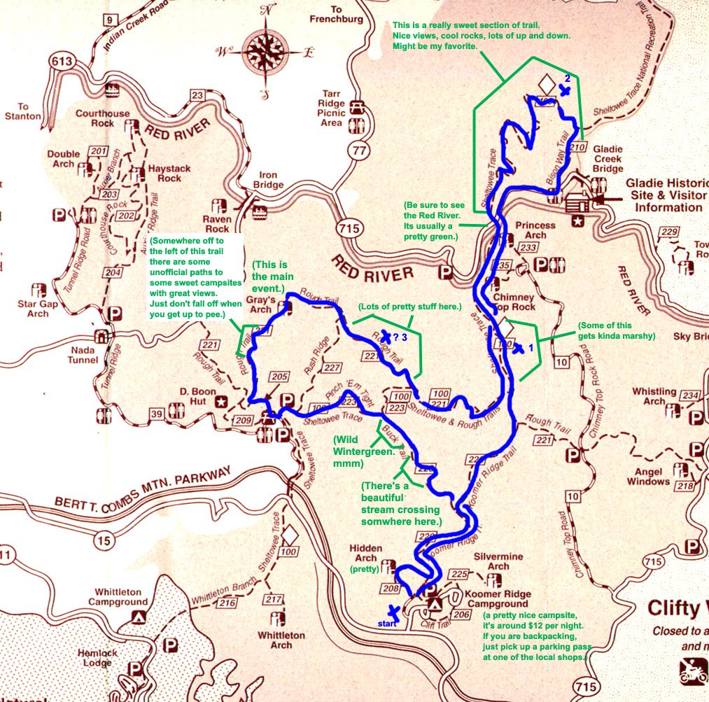
A great tripKathryn asked for some information on Red River Gorge, so I annotated this map showing most of what I know about it. It seemed like the type of thing that ought to be on the internet. The blue line shows a four day backpacking trip I took with Rolli and Lauren in the spring of 2005, and the blue Xs show approximately where we camped. I've taken the trails that cut across sections of that southern loop, and they aren't as pretty as the rest of the park, but there are some neat views in places. The map underneath is from
kywilderness.com. I definitely recommend chewing on some fresh wintergreen if you get the chance.
I'd recommend the pulled cream candy in the gas station outside of the park, but the woman who made them died this past year and her son couldn't keep up the business. It's the end of an era. They still sell Ale 8 however, so if you take a trip there and this map helps you, drink one for me. :)


1 comment:
Hi, Ryan! Your blue X number 2 is right on the Indian Staircase, which I just mapped out at http://rrgtoday.com/maps.html. Did you get a chance to go up the staircase? It's a really cool climb!
Post a Comment